


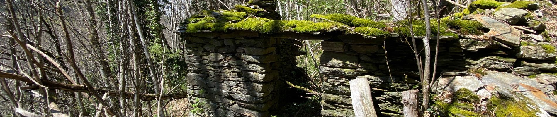
Saint julien d’Arpaon

Roger Philippe Wallez
User GUIDE
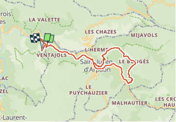

Length
19.9 km

Max alt
970 m

Uphill gradient
782 m
Km-Effort
30 km

Min alt
606 m

Downhill gradient
781 m
Boucle
Yes
Creation date :
2025-04-21 07:39:41.0
Updated on :
2025-04-21 14:53:47.065
7h12
Difficulty : Very difficult

FREE GPS app for hiking
 SityTrail
IGN / Geographical institutes
SityTrail Plus
The world is yours!
About
Trail Walking of 19.9 km to be discovered at Occitania, Lozère, Florac Trois Rivières. This trail is proposed by Roger Philippe Wallez.
Photos


Positioning
Country:
France
Region :
Occitania
Department/Province :
Lozère
Municipality :
Florac Trois Rivières
Location:
La Salle-Prunet
Start:(Dec)
Start:(UTM)
550080 ; 4906261 (31T) N.
Comments